
विषयसूची
छिटो जवाफ
For a Nepal land-boundary dispute, preserve official title and survey records, obtain a notified technical measurement, document the site, and use a precise settlement or lawful interim and court remedy instead of self-help.
मुख्य तथ्यहरू
- ✓Lalpurja, cadastral records and physical possession must be compared together.
- ✓Napi establishes technical survey facts; complex private title disputes may require court adjudication.
- ✓Measurement should identify the correct parcel and follow notice and record requirements.
- ✓A complaint does not necessarily create an automatic Rokka.
- ✓Act promptly because limitation rules and changing site evidence can affect the claim.
Land boundary and encroachment disputes in Nepal
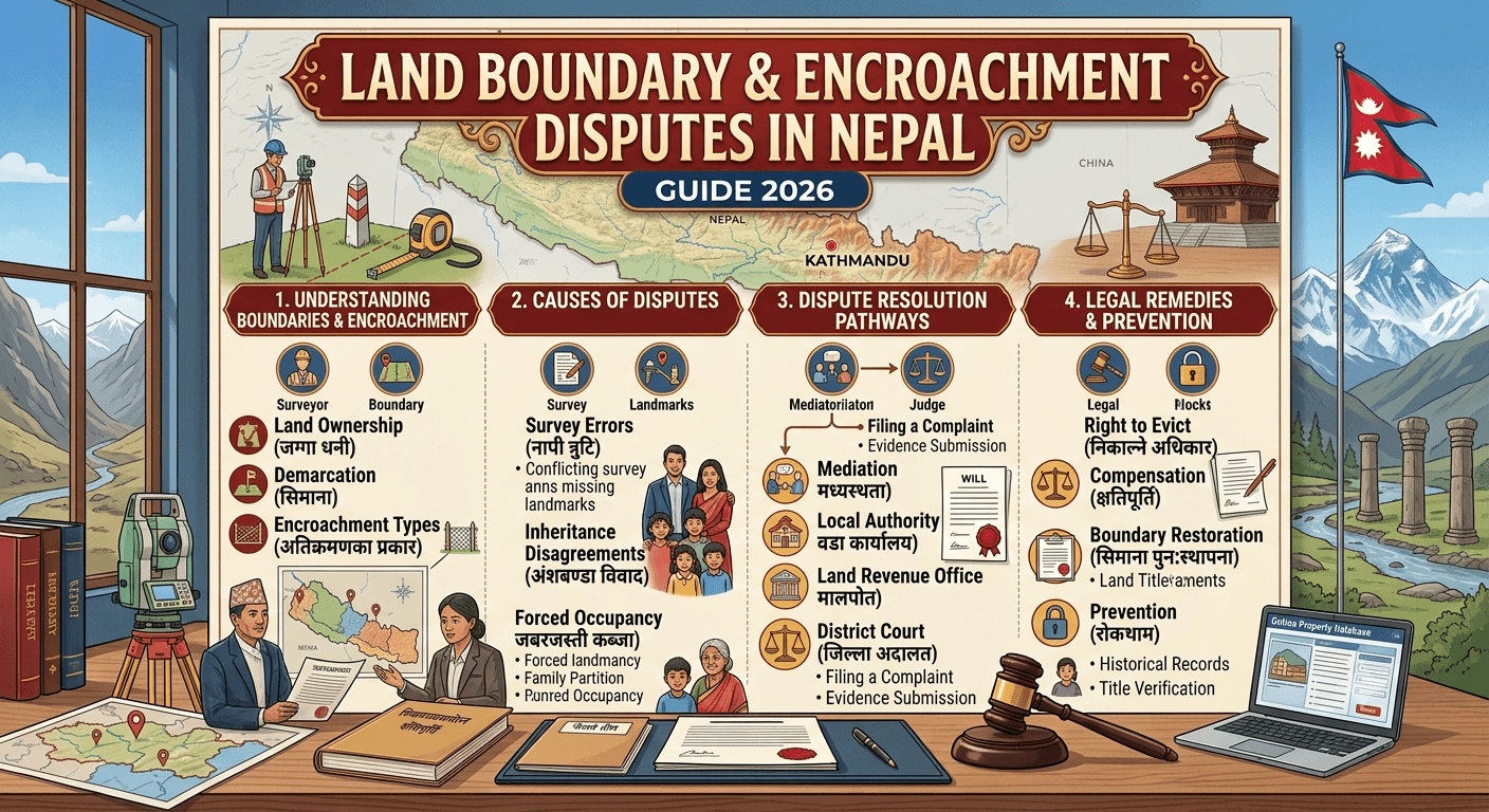
A boundary dispute begins when the physical fence, wall, building, road or occupation does not match the legally relevant parcel boundary. An encroachment claim alleges that a person has occupied, built on or interfered with land beyond their lawful right.
Quick answer
Do not move markers or use force. Secure the Lalpurja, current ownership record, cadastral map, field book, plot register, prior deeds, tax receipts and dated site evidence. Obtain an official or legally usable measurement with notice to affected neighbours, compare the technical records with title and possession, send a precise legal notice, and seek an appropriate restriction, injunction, recovery, removal or compensation remedy before evidence or title changes.
Which authority does what?
- The Survey or Napi office maintains cadastral maps and technical survey records and performs authorised measurement or correction functions. - The Land Revenue or Malpot office maintains registration and ownership records, implements registration and Dakhil Kharij, and records a lawful Rokka or release. - The local level may hold road, building, tax and local boundary material, but a local recommendation does not by itself decide private title. - The competent court decides contested civil rights and may grant relief under applicable substantive and procedural law.
A map measurement can establish technical facts. It does not automatically resolve a competing deed, inheritance, fraud or ownership claim.
Immediate evidence checklist
Collect certified or verifiable copies of: 1. current Lalpurja and ownership register extract; 2. cadastral map, trace map, field book and plot register; 3. every relevant deed, partition paper, judgment or inheritance record; 4. land-revenue and municipal tax receipts; 5. dated photographs, video and a site sketch showing fixed points; 6. building permits, road records and approved plans where relevant; 7. correspondence, notices and admissions; and 8. names of neighbours, survey personnel and other witnesses.
Preserve original files and metadata. Avoid editing images or relying only on screenshots.
Measurement and demarcation
Identify the district, local level, ward, map sheet and kitta before applying. Ensure affected parties receive the required notice and attend if possible. The measurement should connect the parcel to recognised survey control and records, identify any map-ground discrepancy and produce a written record rather than an informal verbal conclusion.
If the map, field book and ground disagree, determine whether the issue is a measurement error, map correction, subdivision mistake, missing record, road change or title dispute. Use the statutory correction route; never alter a cadastral record privately.
Legal notice and settlement
A useful notice identifies the parties and parcel, explains the exact interference, attaches or offers the supporting record, demands a defined action and preserves legal rights. A vague demand to “leave my land” is often inadequate.
Settlement can fix a boundary through an agreed survey, permanent markers, access arrangements, construction changes and cost allocation. Any settlement affecting registrable land rights should use the correct deed, approval and registration process. A private sketch alone may not bind future owners.
Rokka and interim protection
Where a disputed parcel may be transferred, mortgaged, subdivided or materially changed, obtain urgent advice about a lawful Rokka request or court interim order. The Land Revenue Act provides for Rokka in specified circumstances and requires Malpot to act on lawful communications from courts and competent offices. Filing a complaint does not always freeze a parcel automatically.
Court remedies
Depending on the facts, claims may seek declaration of right, protection or recovery of possession, removal of encroachment, injunction, correction or cancellation connected with invalid records, damages, or implementation of an agreement. The correct defendants, parcel description, valuation, jurisdiction, limitation period and requested relief matter.
Do not assume every boundary problem has the same filing deadline. Nepal law contains claim-specific limitation rules, and delay may seriously affect relief.
Common mistakes
- building a counter-wall or forcibly evicting an occupant; - buying or selling while the boundary is unresolved; - treating a broker map or online image as a certified cadastral record; - measuring without identifying the correct kitta or notifying neighbours; - confusing possession with ownership; and - waiting until construction destroys the earlier site evidence.
Review note
This guide was legally reviewed on 21 July 2026. Office practice, records and remedies must be checked for the parcel and facts.
सामान्य प्रश्नहरू
बारम्बार सोधिने प्रश्नहरू
आधिकारिक स्रोतहरू
यो मार्गदर्शनको कानुनी समीक्षाका लागि प्रयोग गरिएका प्राथमिक सामग्री।
- 1.Nepal Law Commission - National Civil Code 2074पहुँच गरिएको २०२६ जुलाई २१
- 2.Nepal Law Commission - Land Revenue Act 2034पहुँच गरिएको २०२६ जुलाई २१
- 3.Nepal Law Commission - Land Survey and Measurement Act 2019पहुँच गरिएको २०२६ जुलाई २१
- 4.Nepal Law Commission - National Civil Procedure Code 2074पहुँच गरिएको २०२६ जुलाई २१
व्यावसायिक सहयोग
व्यावसायिक कानुनी सहयोग चाहिन्छ?
तपाईंको विषय, कागजात र अनुपालन आवश्यकता अनुसार अधिवक्ता-नेतृत्वको मार्गदर्शन प्राप्त गर्नुहोस्।
सम्बन्धित कानुनी सेवा हेर्नुहोस् →सम्पादकीय तथा कानुनी समीक्षा
समीक्षक: Wakil Nepal Legal Team
अन्तिम समीक्षा: २०२६ जुलाई २१
यो मार्गदर्शनले सामान्य कानुनी जानकारी प्रदान गर्छ। प्रक्रिया र आधिकारिक आवश्यकता परिवर्तन हुन सक्छन्, र विषय-विशेष सल्लाह आवश्यक हुन सक्छ।